


la colle du rouet

bernir
User
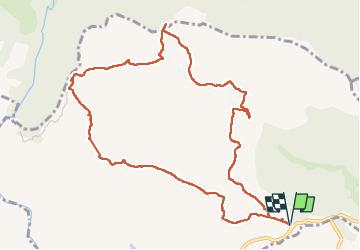

Length
11.9 km

Max alt
408 m

Uphill gradient
338 m
Km-Effort
16.4 km

Min alt
103 m

Downhill gradient
338 m
Boucle
Yes
Creation date :
2024-02-01 08:58:29.488
Updated on :
2024-02-05 16:49:40.393
3h43
Difficulty : Easy

FREE GPS app for hiking
 SityTrail
IGN / Geographical institutes
SityTrail Plus
The world is yours!
About
Trail Walking of 11.9 km to be discovered at Provence-Alpes-Côte d'Azur, Var, Le Muy. This trail is proposed by bernir.
Positioning
Country:
France
Region :
Provence-Alpes-Côte d'Azur
Department/Province :
Var
Municipality :
Le Muy
Location:
Unknown
Start:(Dec)
Start:(UTM)
308439 ; 4820845 (32T) N.
Comments
très beau parcours.varie.il faut un bon gps pour contourner le pic rebequier.beaux points de vue.itinetzire conforme